After driving through the night from our home base in Mount Desert, Maine, spending a couple of hours at Nubble Lighthouse (Part 5) and stopping along the road for Buoys & Flowers (Part 6), we arrived in Ogunquit, Maine for a bit of breakfast and a look at this picturesque & quintessential Maine small harbor town.
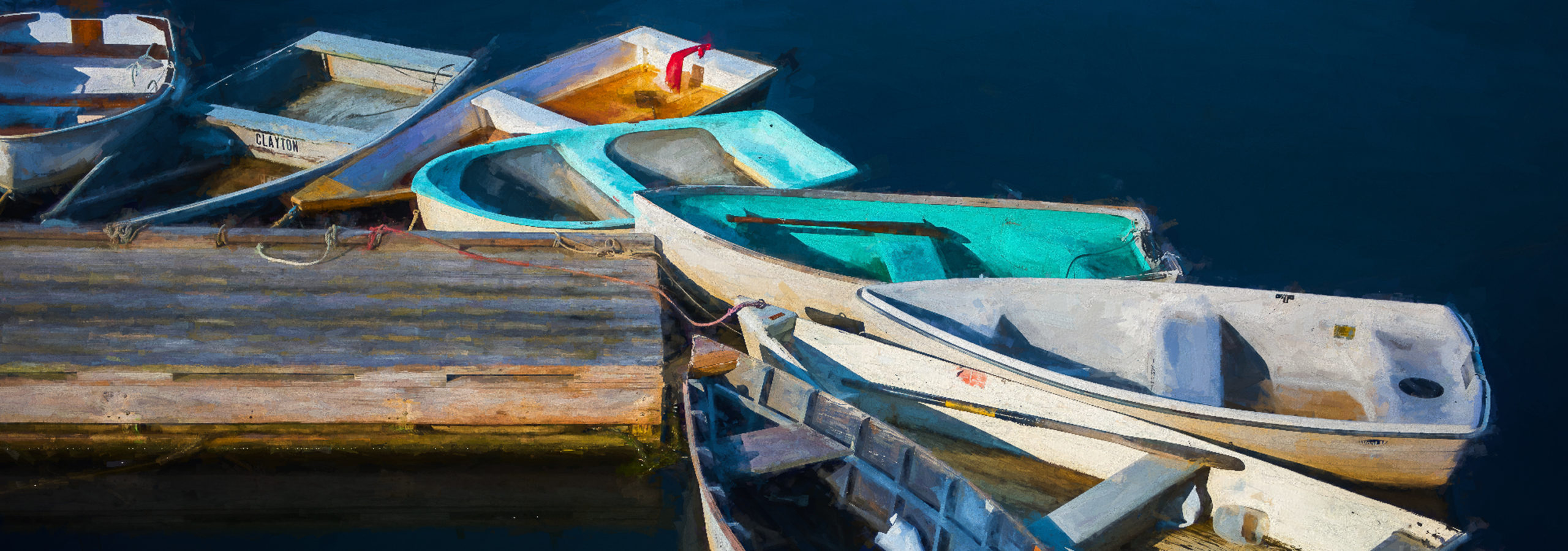
We had a yummy breakfast at Cove Cafe including some amazing Chocolate Banana Bread! After getting refueled, we walked down the street to the harbor dock where the dinghies (above) from the lobster boats were tied up along the dock.
Wikipedia info:
“Ogunquit, which means “beautiful place by the sea” in the indigenous Abenaki language, was first a village within Wells, which was settled in 1641. The first sawmill here was established in 1686, and shipbuilding developed along the tidal Ogunquit River. Local shipwrights built schooners, brigs and dories. At what was then called Fish Cove, near the unnavigable Josias River, fishing was a major livelihood. But the cove was unprotected by a headland or breakwater from Atlantic storms, so fishermen had to protect their boats by hauling them ashore each night. Resolving to create a safe anchorage, they formed the Fish Cove Harbor Association, and dug a channel across land they purchased to connect Fish Cove with the Josias River. When the trench was complete, erosion helped to further widen the passage. The resulting tidewater basin is called Perkins Cove, spanned by a manually operated draw footbridge. With a 3½-mile beach of pale sand and dunes forming a barrier peninsula, connected to the mainland in 1888 by bridge across the Ogunquit River, the village was discovered by artists. It became a popular art colony and tourist area. Particularly after 1898, when the Ogunquit Art Colony was established, it was not unusual to see both artists and fishermen working around Perkins Cove. To accommodate summer crowds, several seaside hotels and inns were built. Marginal Way, a scenic trail, runs along the coast from Perkins Cove to Ogunquit Beach. Ogunquit separated from Wells in 1980 and receives visitors from as far as Australia.”
We made our way down the dock to the pedestrian bridge that Andy had been telling us about. If you are on the bridge when a boat needs to go through you are required to hit the button on either end of the bridge and, of course, you have to hit it again when the boat is clear, to close it!
We spent some time looking through the many shops along the main street. There were some interesting artists shops that we spent some time in. Andy told me there was an interesting house over on the shore that you could only see really well through the window of one of the shops. After first going into the wrong shop (no windows in the back) I found the right one and proceeded to try to get a shot through the glass with a bunch of items for sale in my way! But I managed to get one image that I thought would work!

The sky was a bit dull that morning so I used a new plugin called LandscapePro to replace the sky and it did a great job of changing the overall lighting to match the sky and brighten up the foreground water, the lawn & garden in front of the house!
One of the shopkeepers told Andy we should go out on the Marginal Way Trail that goes up & along the shore. There were some views looking back at the town but I enjoyed the many flowers I found along the way.
If you are looking for some great food (there are many restaurants) and a nice little town and trail to visit, I highly recommend Ogunquit! It is so very Maine! Check out their website for more information!
We hopped into our vehicles and left Ogunquit heading back toward Portland! But we made a quick stop along the way at Rachel Carson National Wildlife Refuge. Watch for Part 8 coming soon!
To see these images & more please visit my gallery!
That is all for now!
Lynn



Add comment