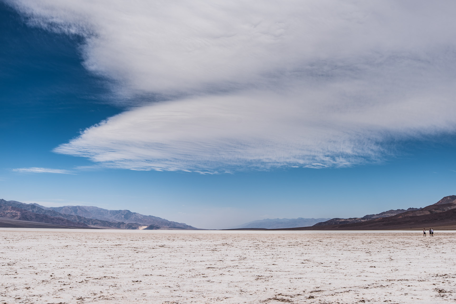
Badwater Basin in Death Valley, CA was an interesting stop on our trip through Death Valley. The April day we were there, the temperature was 103 degrees and the wind was blowing through the valley with gusts of 50-60 MPH.
It was a real challenge to walk and shoot images with wind like this!
From Wikipedia:
Badwater Basin is an endorheic basin in Death Valley National Park, Death Valley, Inyo County, California, noted as the lowest point in North America, with an elevation of 282 ft (86 m) below sea level.[1] Mount Whitney, the highest point in the contiguous 48 United States, is only 84.6 miles (136 km) to the north west.[2]
The site itself consists of a small spring-fed pool of "bad water" next to the road in a sink; the accumulated salts of the surrounding basin make it undrinkable, thus giving it the name. The pool does have animal and plant life, including pickleweed, aquatic insects, and the Badwater snail.
Adjacent to the pool, where water is not always present at the surface, repeated freeze–thaw and evaporation cycles gradually push the thin salt crust into hexagonal honeycomb shapes.
There was a pool of water in the salt near the parking lot. But we were able to walk way out onto the salt flats.
The winds coming through the valley & then going over the mountains, cause lenticular clouds to form. Not something we see in Florida so I was excited that the conditions were right for these clouds to form. Later in the day they were even more intense.
The immensity of Death Valley is incredible & overwhelming. I was glad I had my new Nikon 16-35mm lens to use in these wide open spaces! This lens gives a view that almost matches what I saw that day!
If you are in the area, for sure check out Badwater Basin.
For additional images, please check out my gallery.
That is all for now!
Lynn


Add comment